The final City Road Master Plan was endorsed by the Future Melbourne Committee in June 2016.
The master plan will transform City Road into a safe and welcoming place for everyone. It proposes a series of capital works projects, with an estimated total implementation cost of $38.5 million over a seven year period.
Detailed design is underway for a number of the individual actions proposed in the master plan. The delivery of these actions will be considered by Council as part of future annual budget and service planning processes.
The master plan has been prepared in partnership with VicRoads, the authority responsible for management of the carriageway. VicRoads support the final master plan and will continue working with the City of Melbourne on its implementation.
Consultation closed
Interactive draft plan
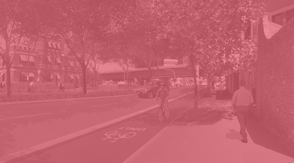
City Road Draft Master Plan
Interactive Plan
Give feedback and read comments


City Road Draft Master Plan
The City Road Master Plan aims to transform City Road into a safe and welcoming place for everyone.
Based on feedback from the community, the draft master plan looks at ways to better balance the road’s two key roles – as an important transport corridor for various modes, and a place that supports the local community.
Draft Master Plan Actions
The draft master plan outlines six actions to improve the layout and design of the road for all its users. Explore the draft master plan by clicking on the six proposed actions for different areas of City Road.
1: Transform City Road West into a great Central City street
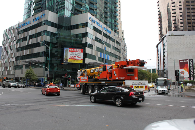
City Road West between Clarendon Street and Power Street is a local street, and can be significantly enhanced to make it safer, more attractive and welcoming. Lower traffic volumes and a growing local community mean that there are opportunities to transform this section of the road into a great central city street.
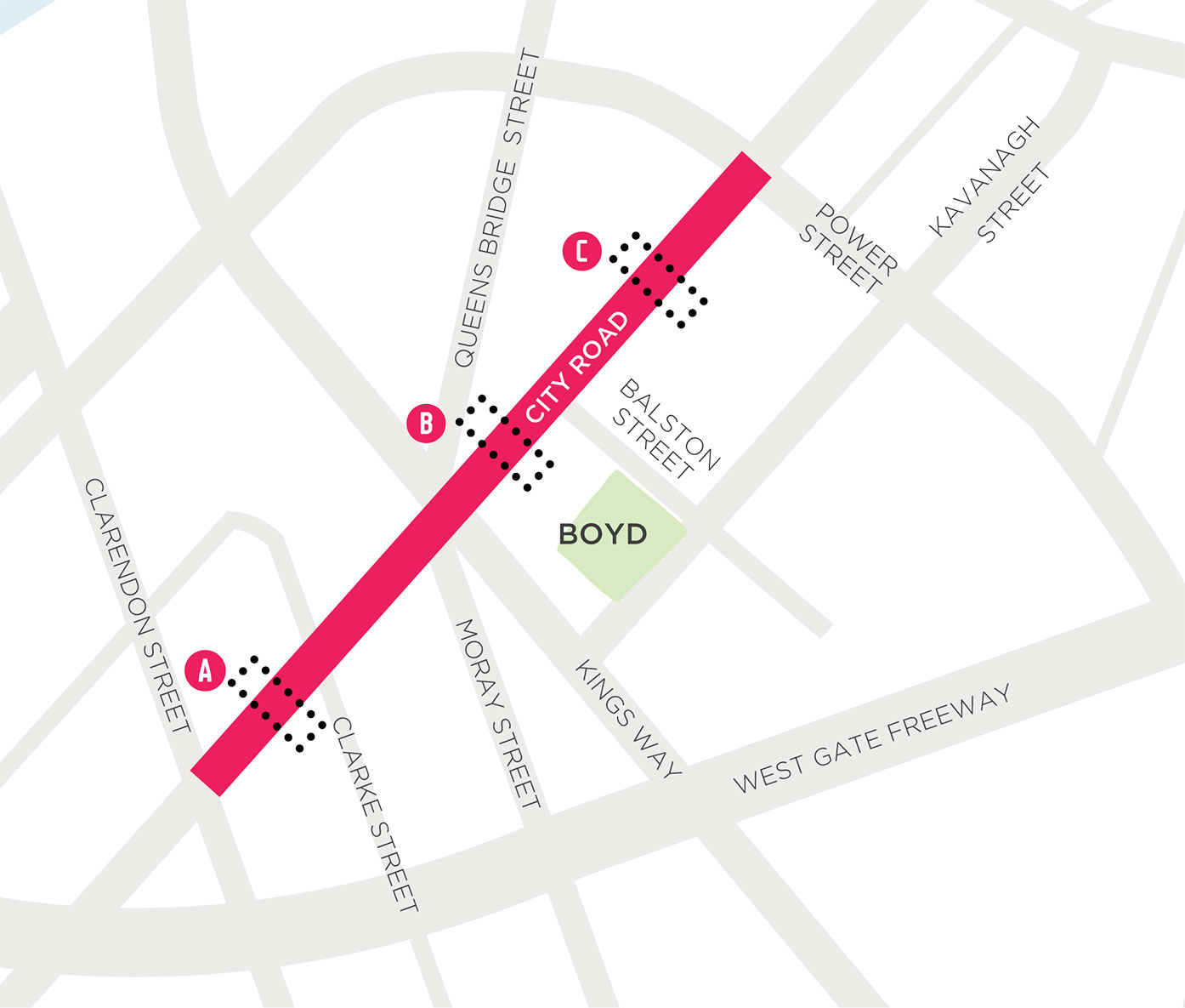
To make it easier to demonstrate the proposed changes, City Road West has been shown in three sections to illustrate the existing and proposed street conditions.
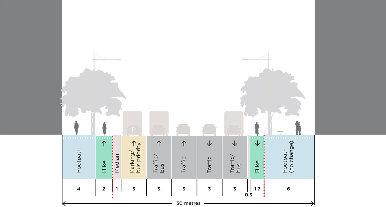
A. Clarendon Street to Queens Bridge Street
Compare the existing and proposed conditions using the slider below.
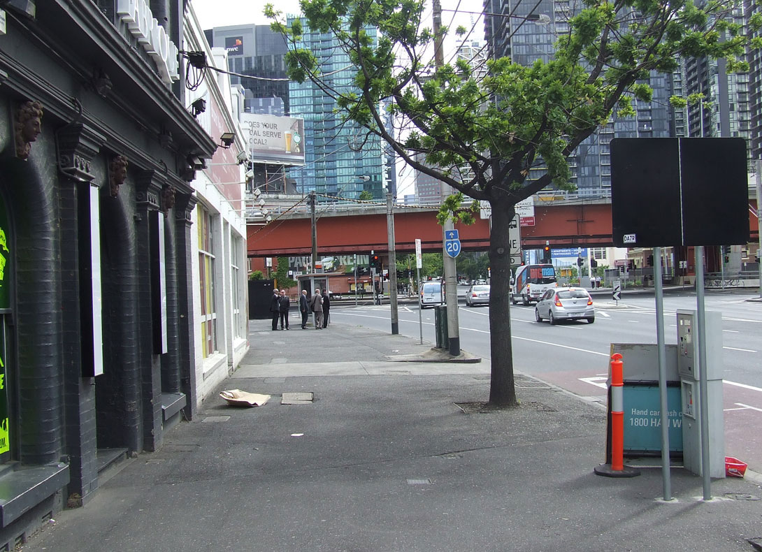
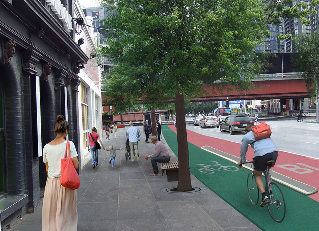
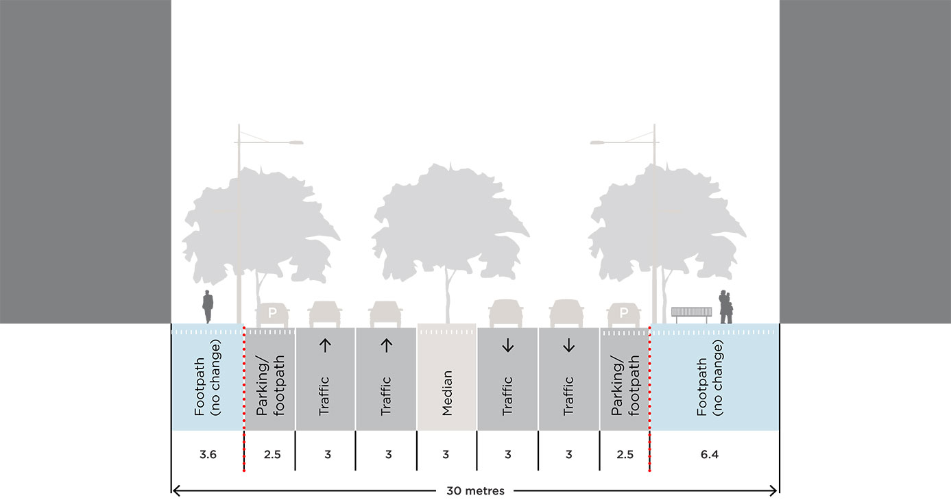
Compare the existing and proposed street section below.
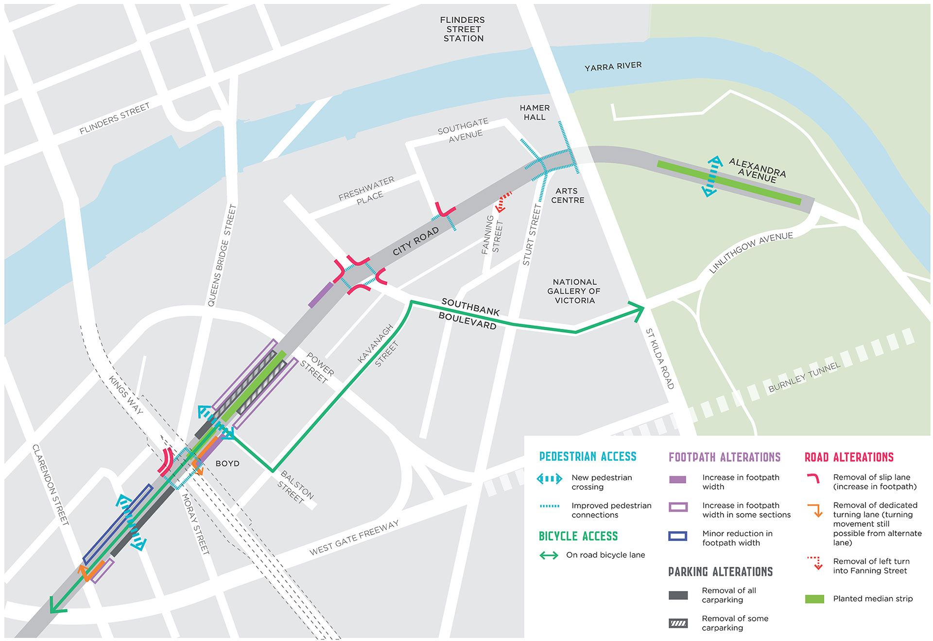
The proposed design introduces a pedestrian crossing at Clarke Street, separated bicycle lanes, new tree planting, high quality materials and maintains bus priority.
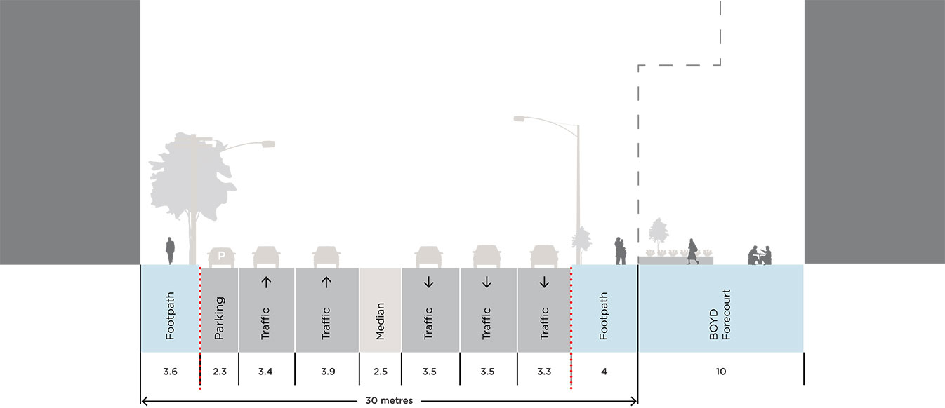
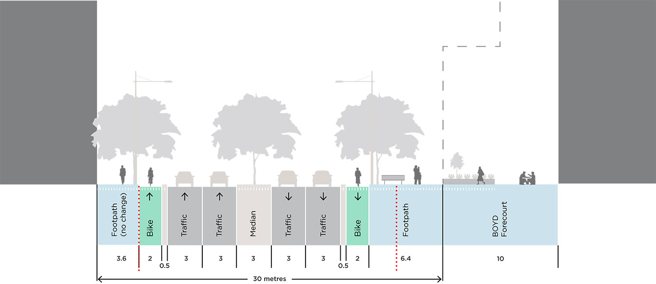
B. Queens Bridge Street to Balston Street
Compare the existing and proposed conditions using the slider below.
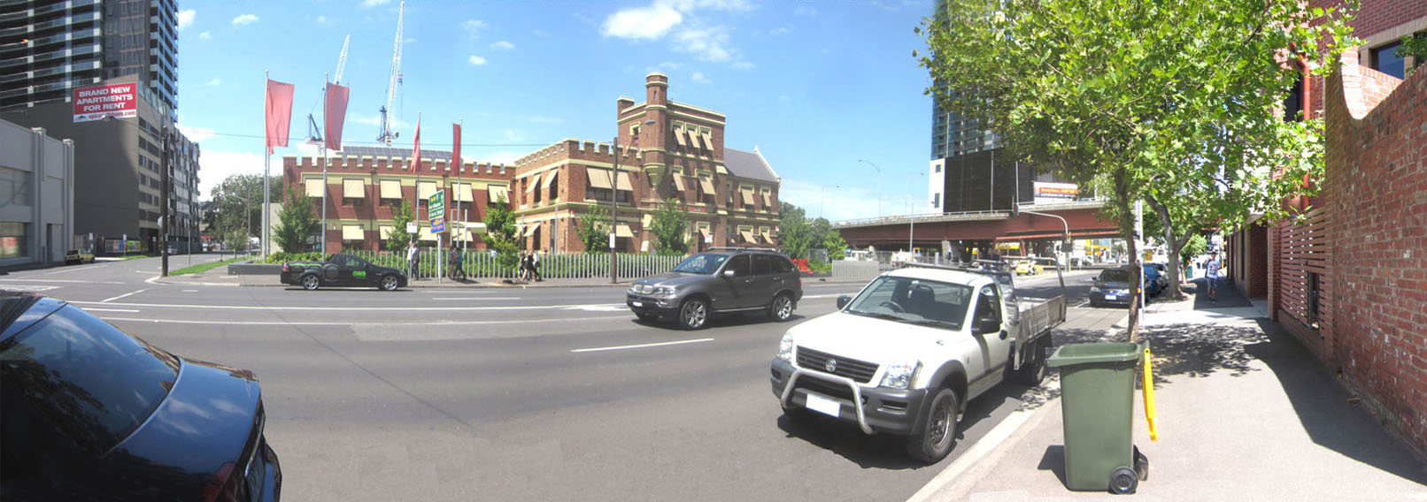
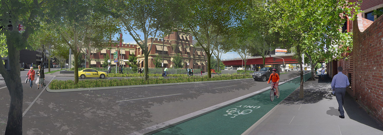
Compare the existing and proposed street section below.
The proposed design introduces a tree lined median, improved pedestrian amenity around the Boyd Community Hub and separated bicycle lanes west of Balston Street.
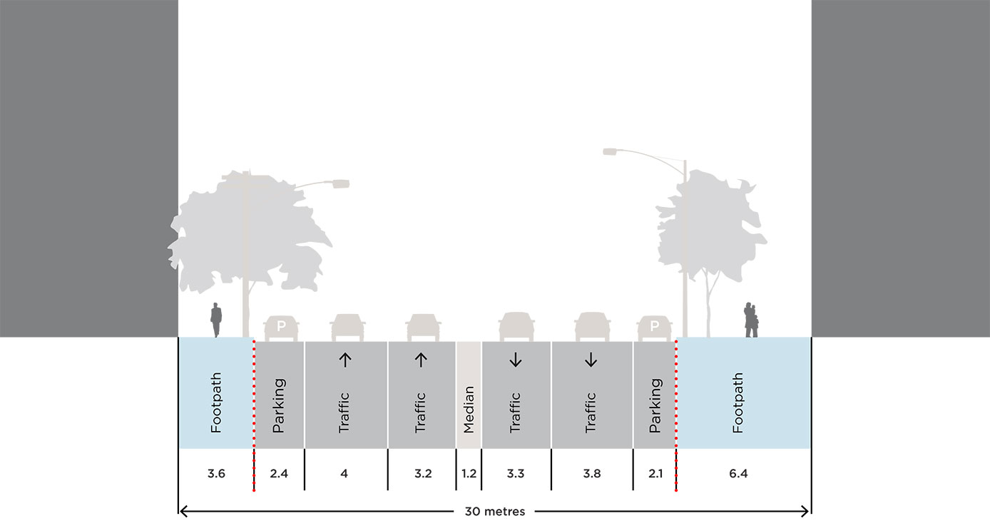
C. Balston Street to Power Street
Compare the existing and proposed conditions using the slider below.
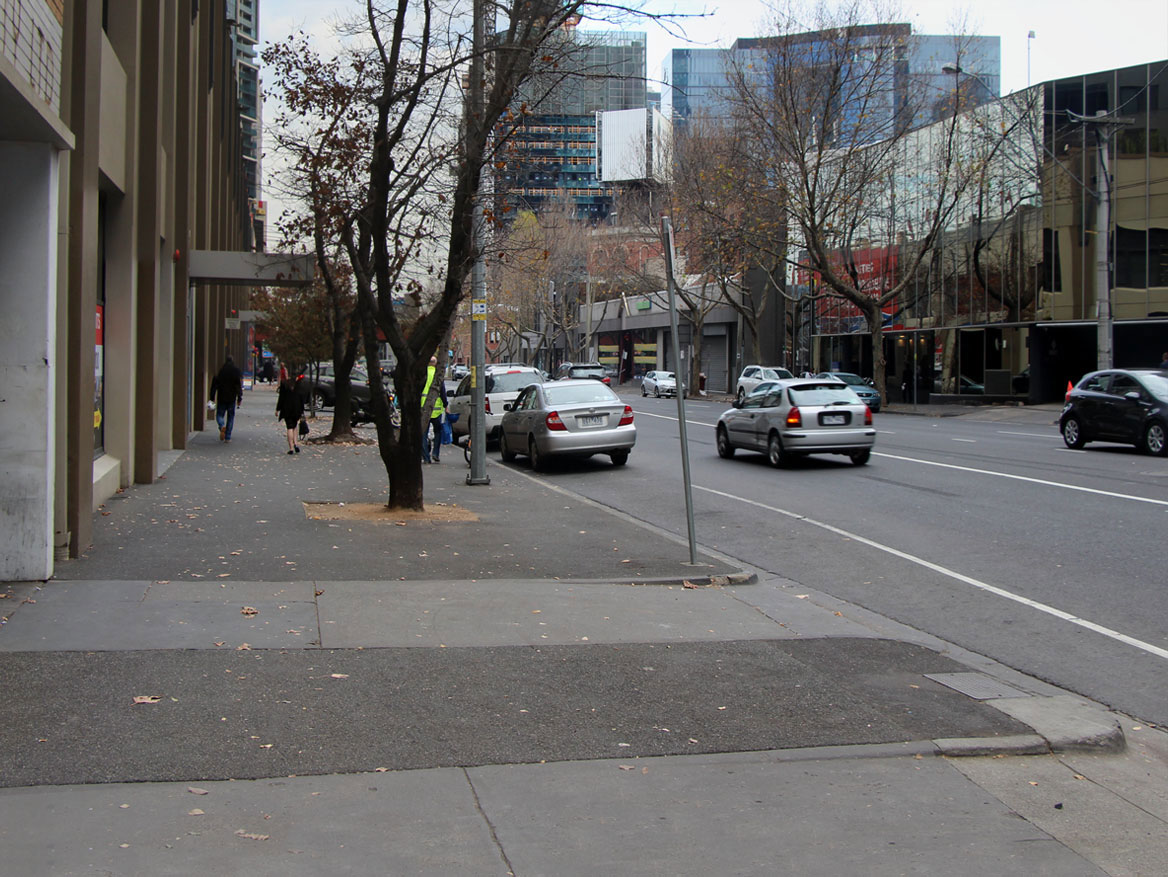
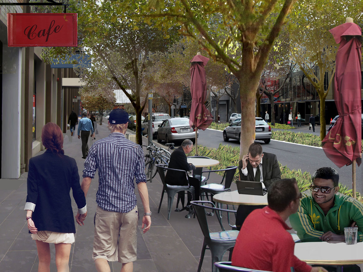
Compare the existing and proposed street section below.
The proposed design introduces a tree lined median and improved pedestrian amenity.
2. Reimagine Kings Way undercroft as a community space
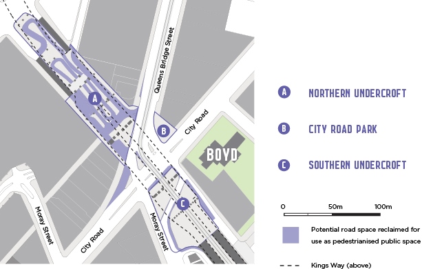
The Kings Way Undercroft and surrounding area presents opportunities for pedestrian and cyclist improvements as well as potential open space upgrades. This action looks to build on the success of the Boyd Community Hub by expanding activity into the redundant spaces of the Kings Way Undercroft, creating a combined area of one hectare of useable public space. The design concepts displayed below illustrate how each of the three sites can be reimagined to better serve the local community.
A. Kings Way Northen Undercroft
Compare the existing and proposed conditions using the slider below.


The Northern Undercroft is located under Kings Way overpass on the northern side of City Road. It is currently occupied by a redundant taxi rank. Consolidating this space would create an area of approximately 5000m2, equivalent to 12 basketball courts. Possible uses and improvements of the Northern Undercroft could include a skate park, sports courts, play spaces, art installations, studios and events.
B. City Road Park
Compare the existing and proposed conditions using the slider below.
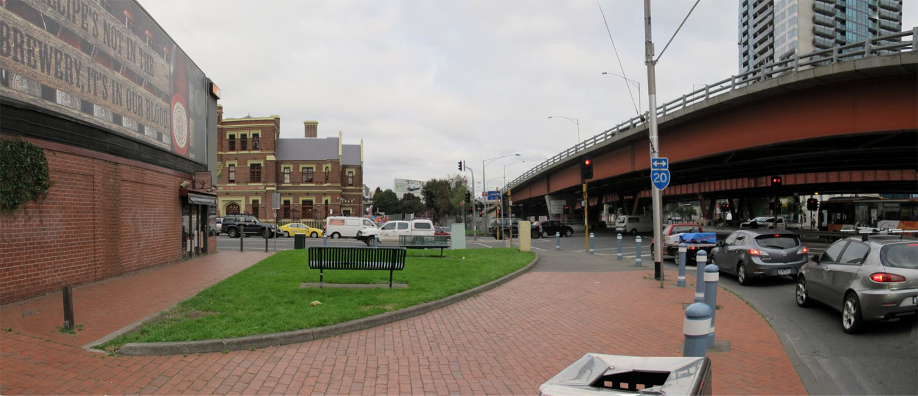
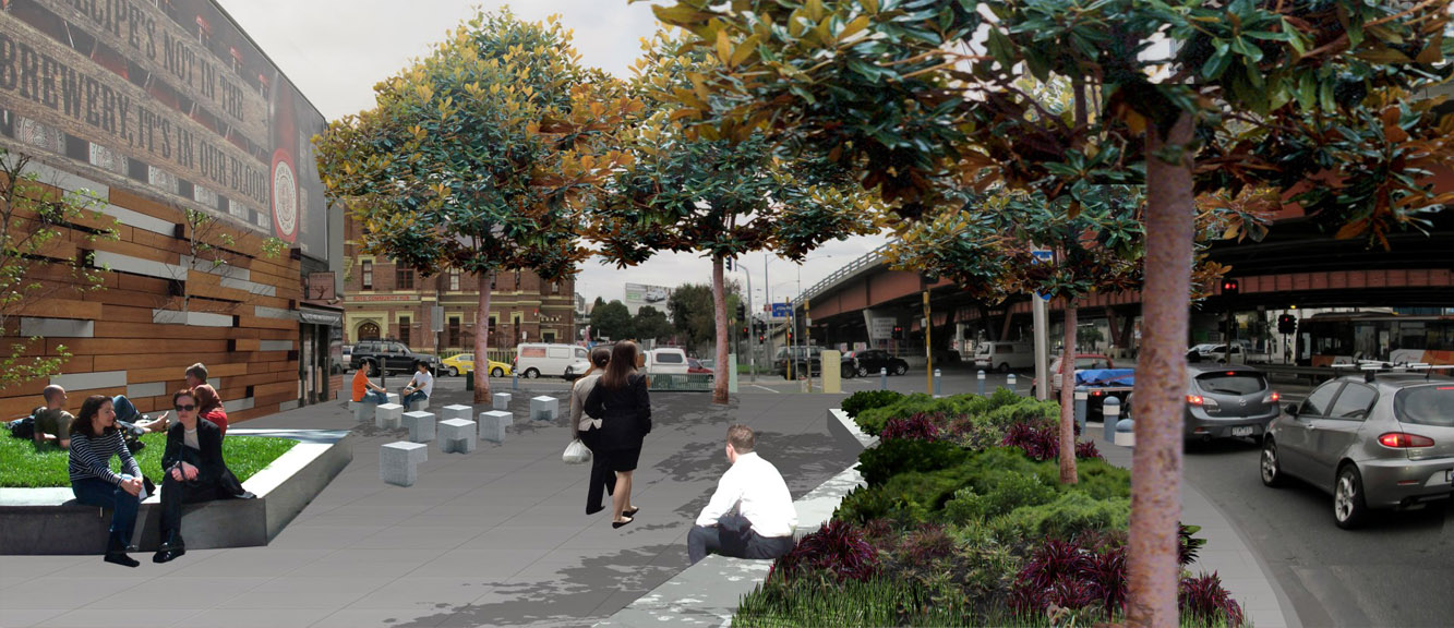
City Road Park is a small park on the corner of City Road and Queens Bridge Street directly opposite Boyd Community Hub. The park lacks adequate shelter, seating or protection from traffic. It is exposed to the adjacent roadways and is dominated by a large advertising billboard. The redesign of City Road Park could include arts and sculpture installations, play elements, water sensitive urban design/rain garden, interactive music and sound and seating.
C. Kings Way Southern Undercroft
Compare the existing and proposed conditions using the slider below.


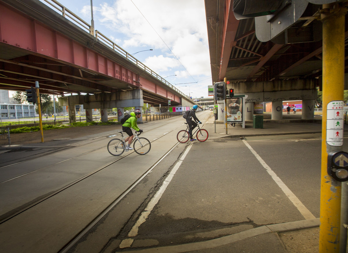
The Southern Undercroft is located to the south of City Road adjacent to Moray Street. This space is difficult for pedestrians to move through. Fences, a lack of paving, flooding issues and poor signage contribute to a feeling of left over space. Possible opportunities for improving the Southern Undercroft could include: removing barriers to pedestrian access, tree planting, green open space, play elements, water sensitive urban design, seating, further tram stop upgrades and lighting upgrades.
Location Map
3. Upgrade City Road East to be safer and easier to get around
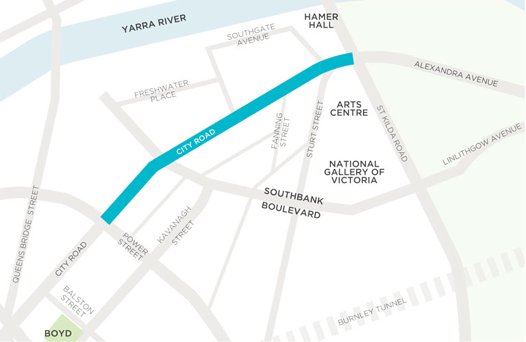
The dominance of traffic has led to City Road East between Power Street and St Kilda Road acting as a barrier that divides Southbank, creating an unpleasant and unsafe pedestrian environment. This action aims to improve safety and amenity by removing slip lanes (at Southbank Boulevard and Southgate Avenue), removing the left turn into Fanning Street and through footpath upgrades and tree planting. City Road East must retain its arterial route function and therefore significant changes are not proposed in this section of the road.
Compare the existing and proposed conditions using the slider below.
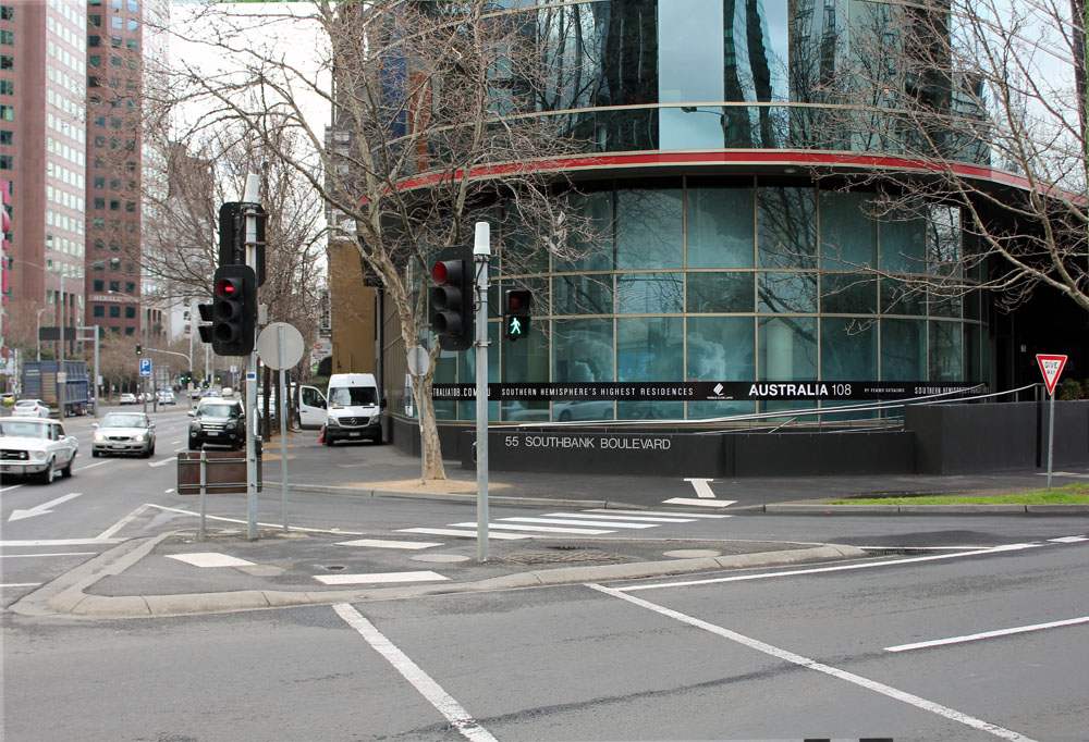
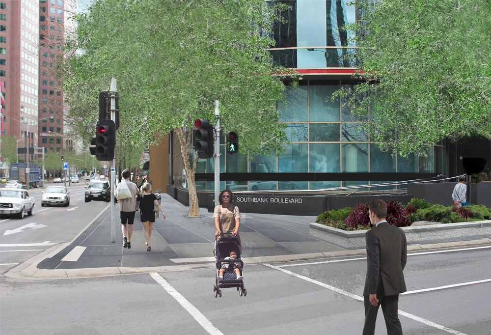
Proposed slip lane removal at Southbank Boulevard.
Location Map
Existing Conditions
4. Connect City Road to the Arts Centre and Yarra River
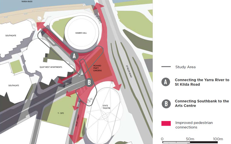
There is an opportunity to improve the interface between City Road and St Kilda Road in order to better integrate the Arts Precinct with Southbank and reconnect City Road to the Hoddle Grid. This action proposes ways to transform the existing disconnected and poor quality pedestrian environment into a connected, inviting and engaging place for people. It is proposed to work with the Victorian Government and the Arts Centre to ensure that master planning for the Arts Centre improves pedestrian connections between City Road and the Arts Precinct.
A. Connecting the Yarra River to St Kilda Road
Compare the existing and proposed conditions using the slider below.


Compare the existing and proposed conditions using the slider below.
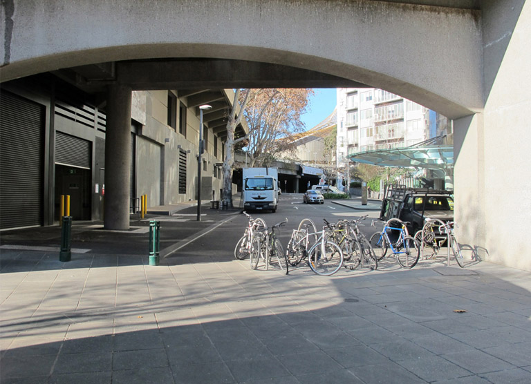
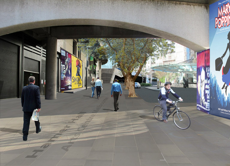
The proposed design concept aims to improve pedestrian connections between St Kilda Road and the Arts Centre lawn to the Yarra River. It includes the upgrade of Southgate Avenue by minimising parking and through traffic while enabling better pedestrian and cycling links.
B. Connecting Southbank to the Arts Centre
Compare the existing and proposed conditions using the slider below.


The proposed design concept aims to create an inviting entrance from City Road to the Arts Centre. A staircase and elevator would provide direct pedestrian connections between City Road and the Arts Centre and would help to integrate Southbank as part of the Arts Precinct.
Location Map
5. Reconfigure Alexandra Avenue as a boulevard
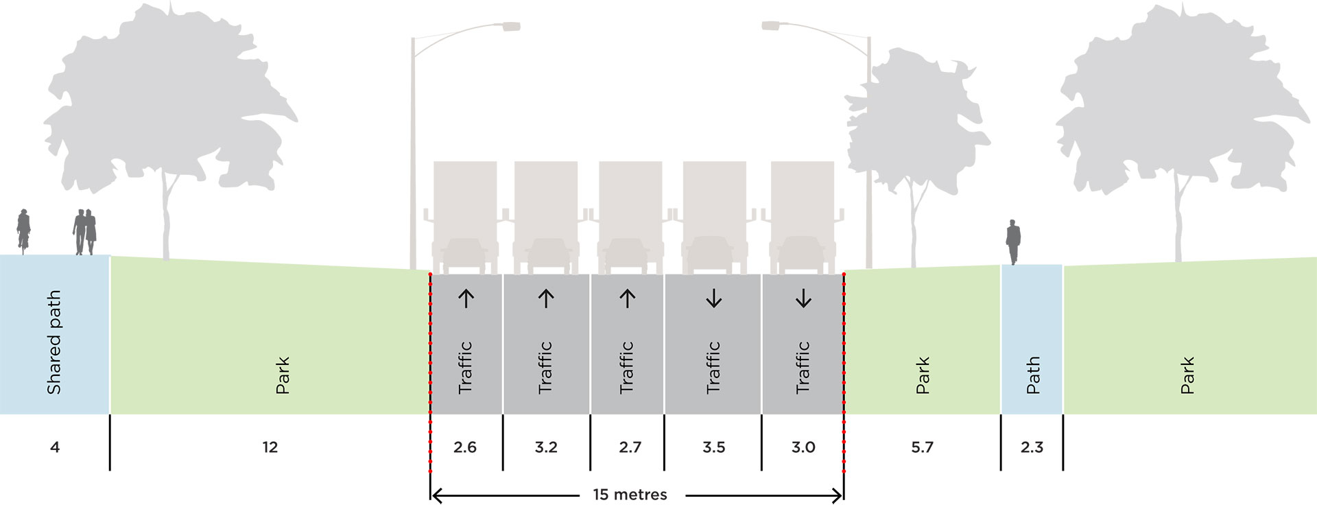
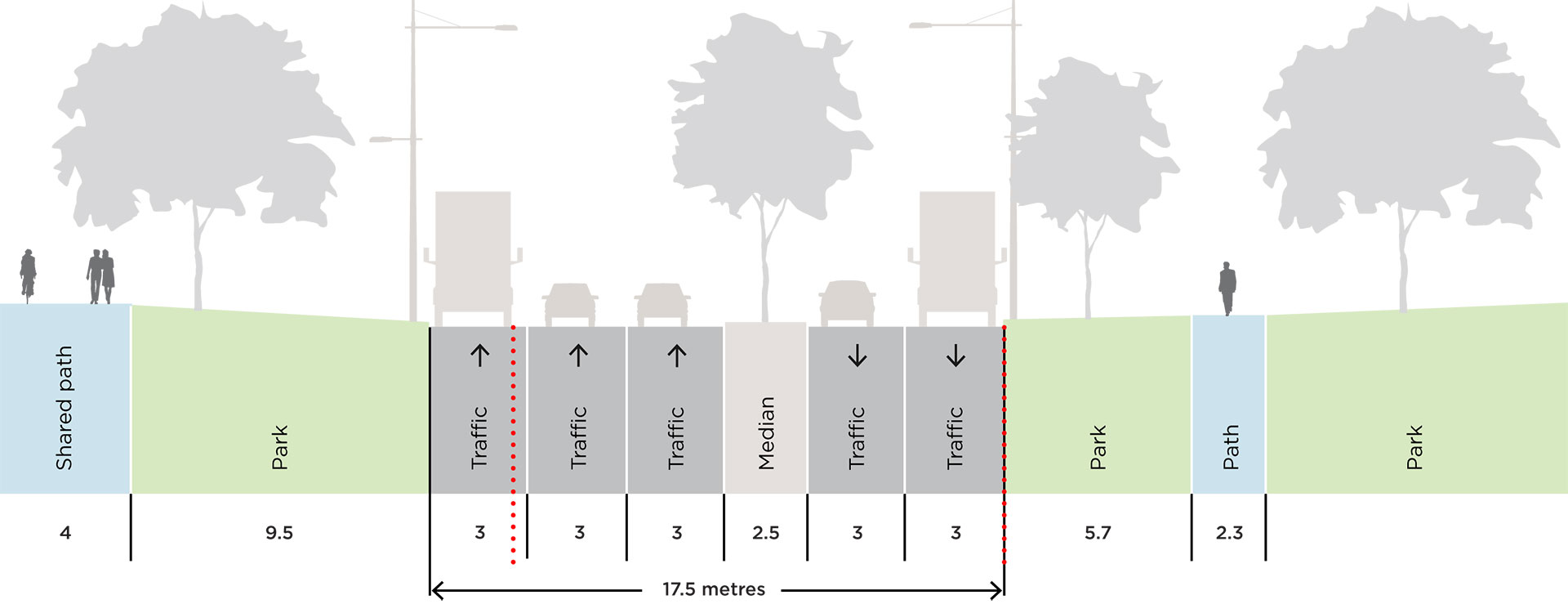
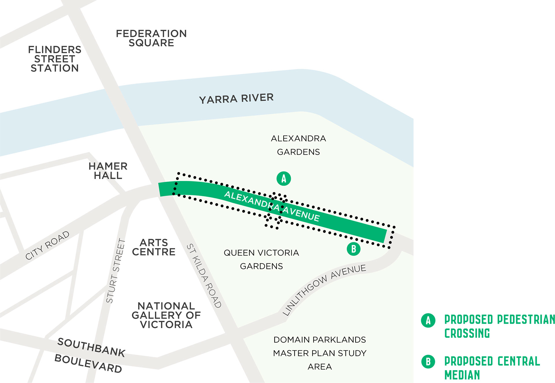
Alexandra Avenue between St Kilda Road and Linlithgow Avenue presents opportunities to improve the connection between two significant gardens and provide an attractive and green gateway to Southbank. In the short term, it is proposed to introduce a signalised pedestrian crossing to connect Alexandra Gardens to Queen Victoria Gardens to improve the usability of the gardens and increase pedestrian safety. A longer term opportunity exists to introduce a central tree-lined median into this section of Alexandra Avenue to create a boulevard that will better integrate into the surrounding gardens and encourage improved driver behaviour. This more transformative proposal will be explored as part of the Domain Master Plan.
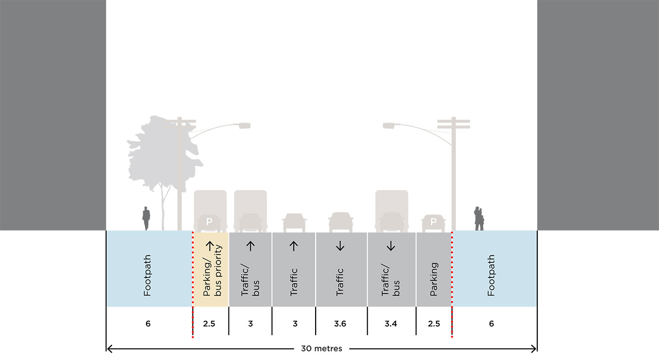
Existing and proposed street section
Compare the existing and proposed street section below.
Location Map
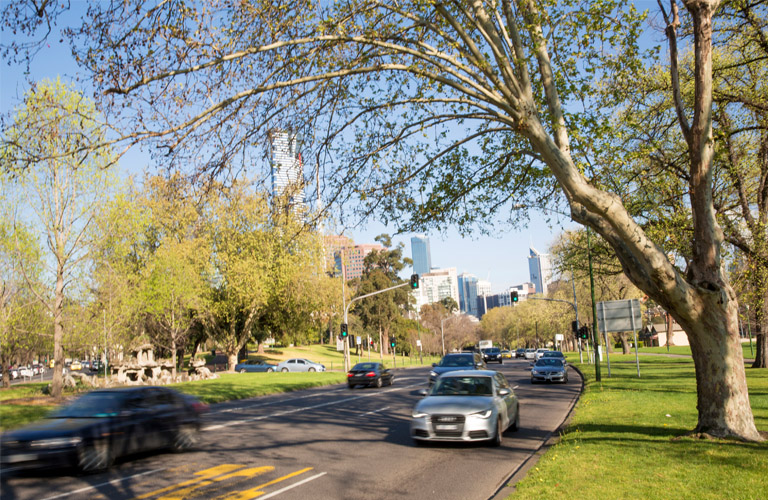
Existing Conditions of Alexandra Avenue
6. Expand the bicycle network within Southbank
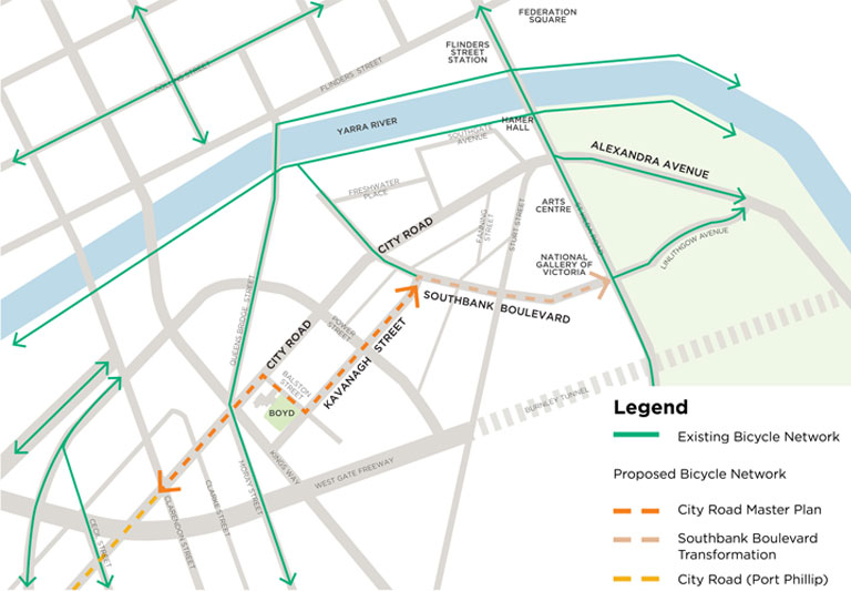
The draft master plan proposes a new on-road bicycle route through Southbank via City Road, Balston Street, Kavanagh Street and Southbank Boulevard. This new bicycle route aims to improve cycling access within Southbank and connect to the existing bicycling network, providing greater options for safe on road cycle journeys.
Separated bicycle lanes are proposed on City Road from Clarendon Street to Balston Street to ensure cyclist safety on this section of the arterial road as part of the design for City Road West (Action 1). Bicycle lanes on Southbank Boulevard will be included as part of the transformation of Southbank Boulevard.
Proposed bicycle route through Southbank
Existing Conditions of cycling in Southbank
Background & Context
Why do we need a City Road Master Plan?
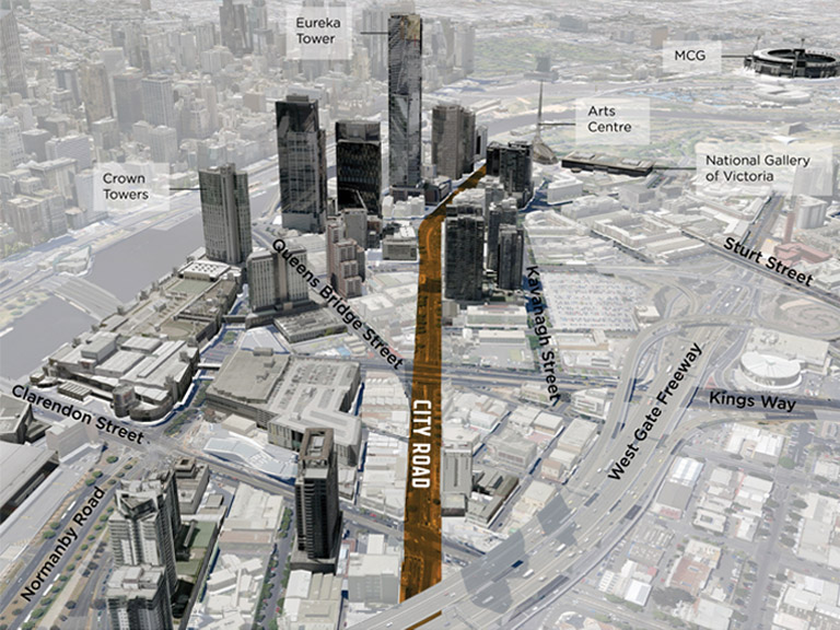
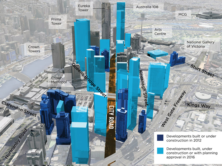
The need to improve City Road is now more important than ever. As Southbank transforms into a high density central city neighbourhood, the role of City Road needs to change to ensure that it is a pleasant place to be as well as a street that is easy and safe to get around.
Study Area
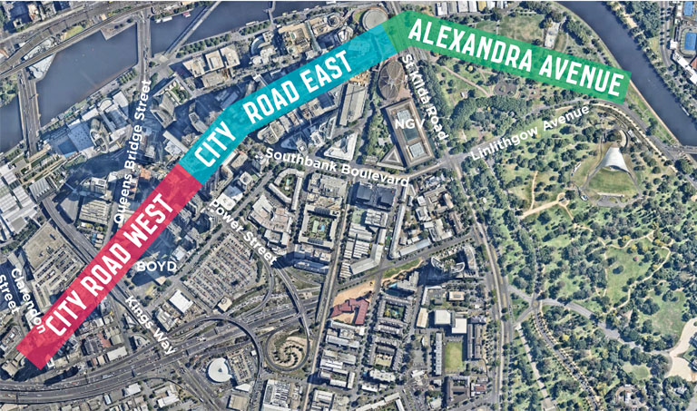
The master plan considers the road in three sections: City Road West, City Road East and Alexandra Avenue. Each section of the road presents different opportunities for improvement.
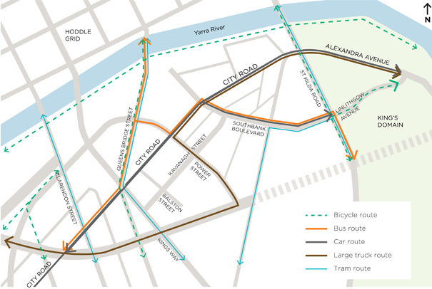
Existing Transport Routes
The street improvements proposed in the draft master plan respond to different transport requirements along City Road and Alexandra Avenue. Due to changing conditions and space limitations along the road, not all transport modes can be accommodated in each section.
Existing Transport Conditions
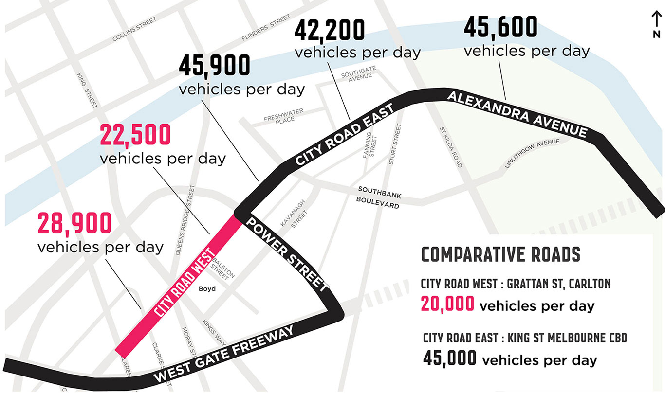
There is significant variation in traffic volumes in different segments of City Road and Alexandra Avenue. City Road’s function as a bypass to the Burnley Tunnel results in far greater traffic volumes east of Power Street compared to City Road west of Power Street. These variations highlight that there are greater opportunities for improvements west of Power Street in the shorter term.
Crashes
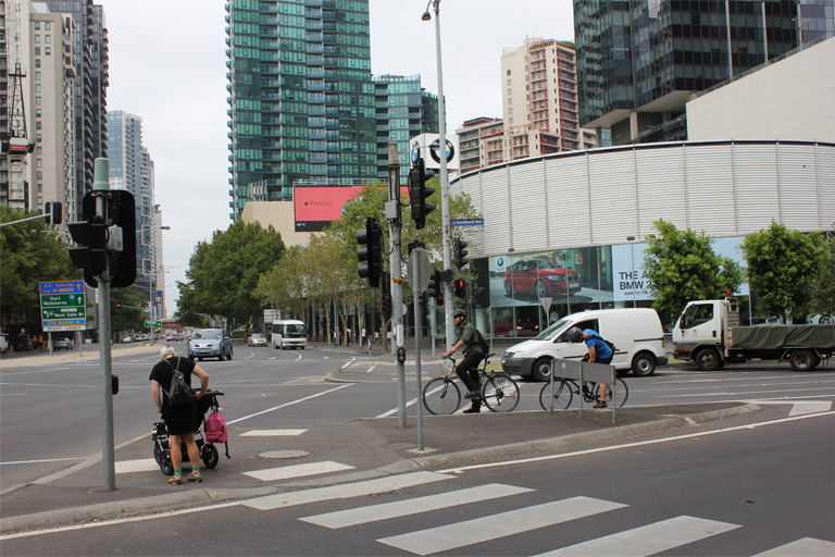
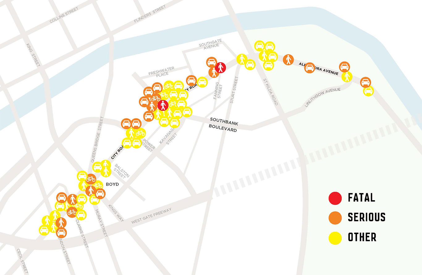
There have been a a number of crashes in City Road, particularly at intersections which are often very large and confusing. Improved safety is a key driver for the master plan and all proposals aim to improve safety for all City Road users.
VicRoads Crash Stats 2008-2012. Source: GHD Traffic and Access Study May 2014
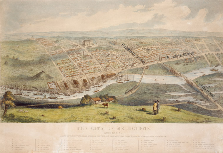
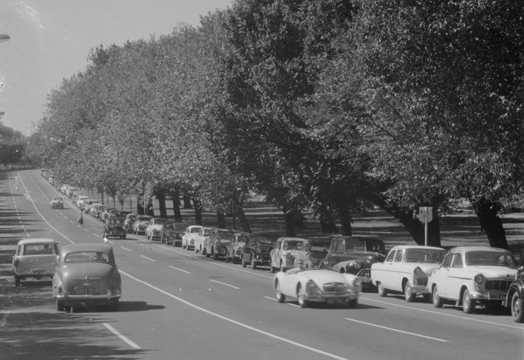
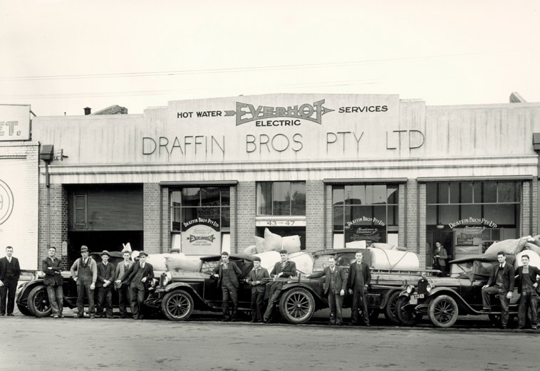
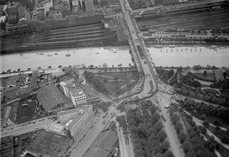
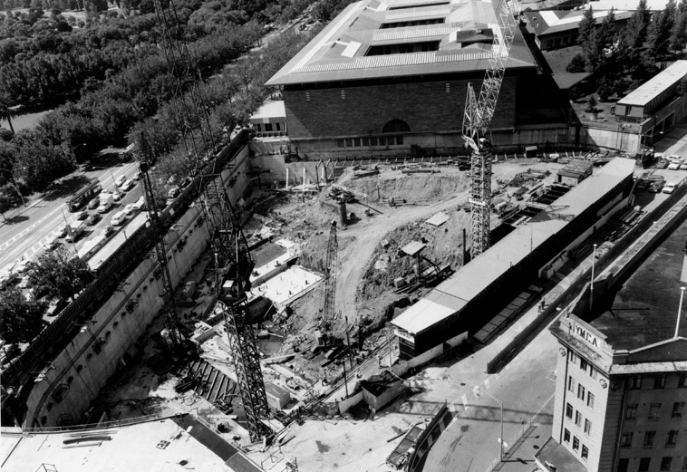
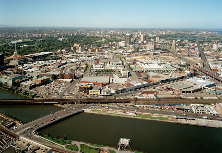
A connection to the past
The public realm plays an important role in the way people experience, value and remember a city. Public spaces have their own stories and history, connecting the experience of the place today to its past.
Benefits and Impacts
What will be the benefits and impacts of the draft Master Plan?
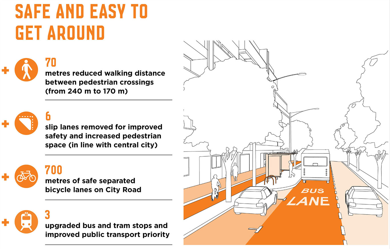
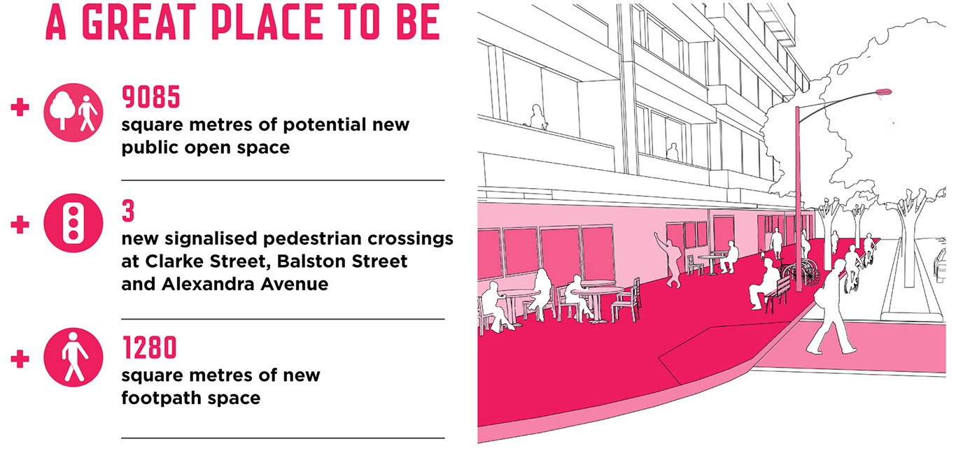
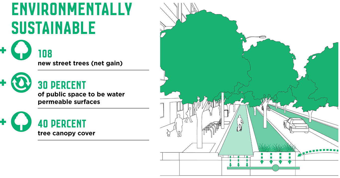
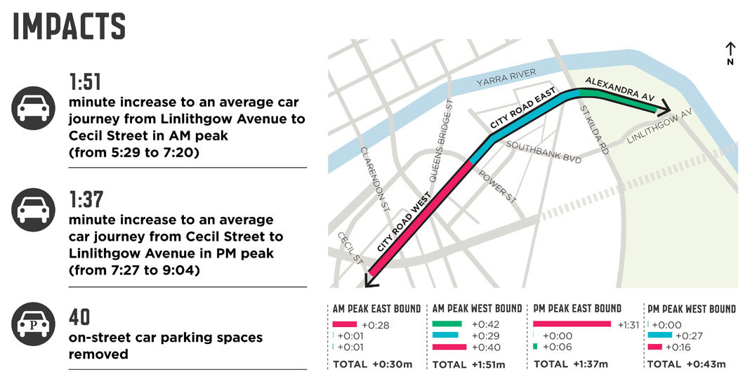
The benefits of the proposed improvements to City Road are significant and will deliver a street that is safer, enjoyable to be in, more sustainable, distinct and characterful. Detailed traffic modelling has been undertaken to develop and understand the impact of the proposed actions presented in the master plan. Whilst there will be some minor increases in vehicle journey times, the various benefits of the proposal are considered to outweigh these impacts.
Document Library
Document Library
City Road Master Plan
Stage 1 - Community Engagement
Stage 2 - Draft City Road Master Plan
Supporting Documents
Timeline
-
Timeline item 1 - complete
Stage 1 Community Engagement
February to March 2014
-
Timeline item 2 - complete
Development of the draft City Road Master Plan
Mid 2015
-
Timeline item 3 - complete
Draft Master Plan Community Engagement
9 September to 21 October 2015
-
Timeline item 4 - complete
Final City Road Master Plan presented to Future Melbourne Committee for endorsement
21 June 2016
FAQs
The City of Melbourne is leading the development of a draft master plan that aims to transform City Road into a safe and welcoming place for everyone. The project delivers key actions from the Southbank Structure Plan 2010, and responds directly to the feedback we heard about how the road is experienced from the initial community engagement in 2014.
It addresses ways to better balance the road’s two primary roles – as an important transport corridor for various modes, and a place that supports local street life that is people-friendly for all the residents, workers and visitors who use City Road.
It considers ways of making City Road more environmentally sustainable, contributing to a liveable and resilient city.
Changes to planning controls that affect private land use and development are not within the scope of this project.
The City of Melbourne conducted one month of community engagement from mid-February to mid-March 2014. During this period, community members were invited to share their experiences of City Road via an interactive online map of the study area. Many people also joined in the conversation with City of Melbourne officers at the Boyd Community Hub during the week of the 24 February 2014.
All the information captured through the first stage of engagement was used to inform the development of the City Road draft Master Plan. The master plan was also informed by extensive traffic analysis and modelling, an Issues and Opportunities report and meetings with key stakeholder groups.
This stage gives the community the opportunity to learn more about the six actions contained in the master plan, and share their thoughts about the design proposals that aim to create a better street.
This feedback will be used to inform the final City Road Master Plan to be released in early 2016.
To get involved, you can provide feedback online via the interactive map on Participate Melbourne or by emailing us.
Alternatively, come along to one of our drop-in sessions at Boyd and/or sign up to a walking tour to learn more about the draft master plan actions. Your feedback will inform the final master plan.
To receive updates on the City Road Master Plan project and events, please email cityroad@melbourne.vic.gov.au.
The draft master plan will explore the length of City Road, extending from Clarendon Street in the west to St Kilda Road in the east and includes Alexandra Avenue to the intersection with Linlithgow Avenue.
In total, the length of the road is approximately two kilometres. The public spaces near Boyd Community Hub have also been addressed.
The City of Melbourne and VicRoads share responsibility for City Road’s management and we are investigating ways that the available road and footpath space can be best used to meet the needs of its various users.
VicRoads is the responsible authority for the road carriageway from kerb to kerb. The City of Melbourne is responsible for the space from kerb line to property boundary.



Comments to be added