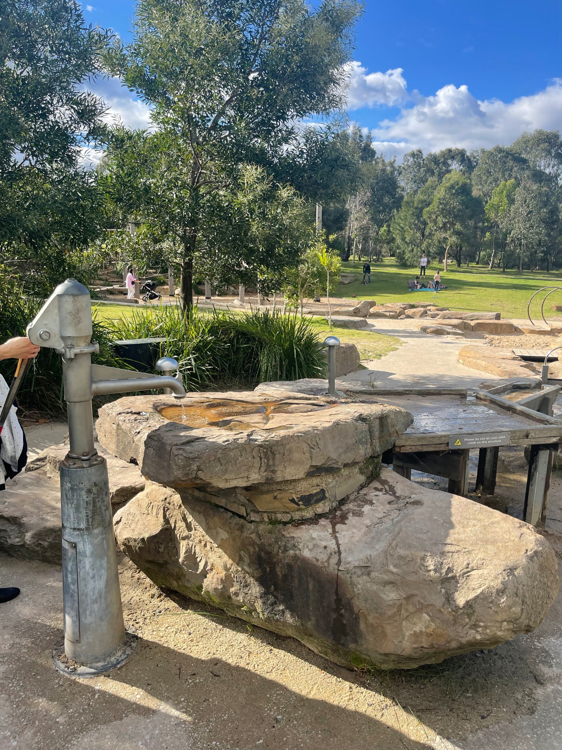
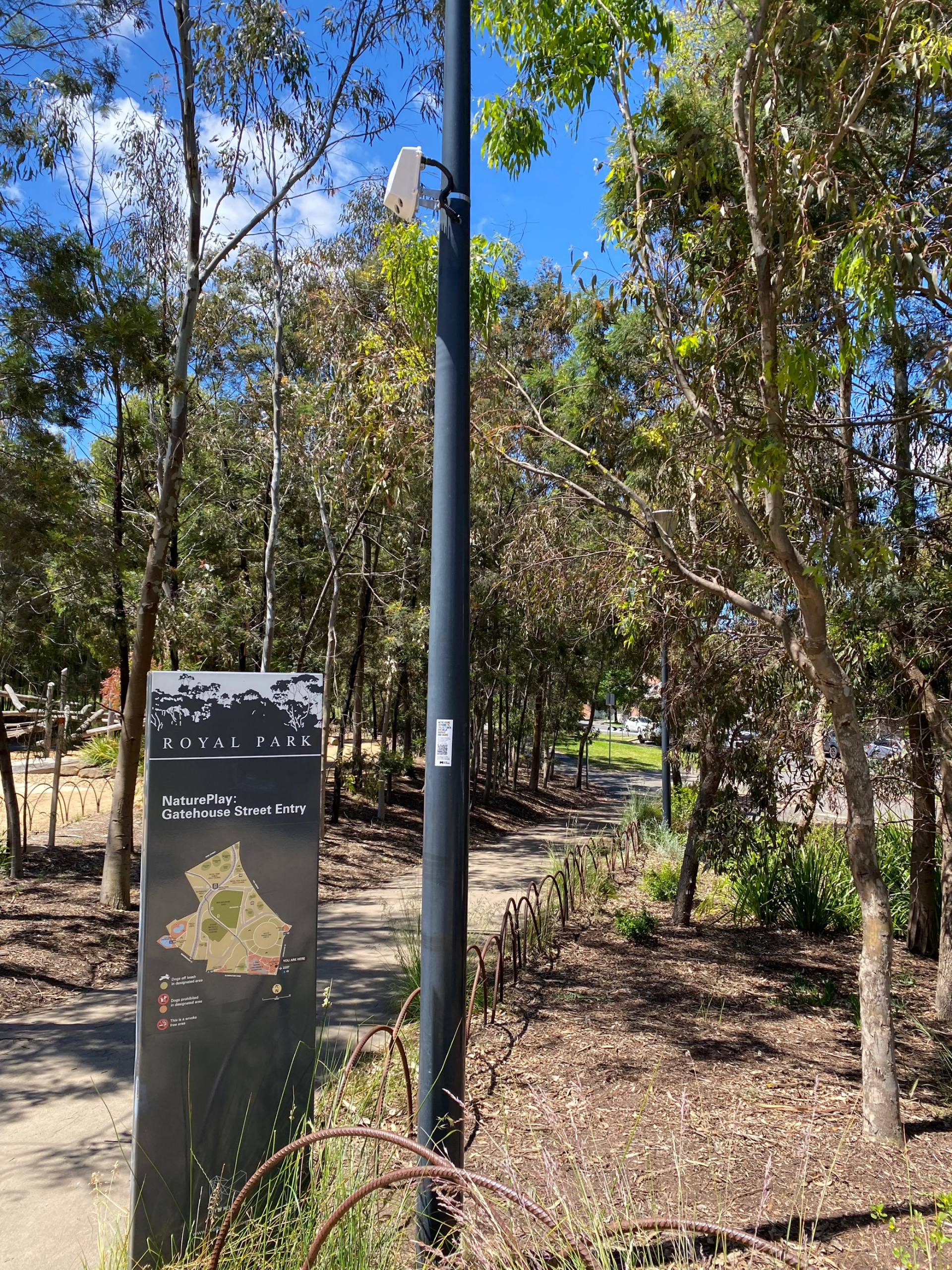
Spanning 170 hectares, Royal Park in Parkville is City of Melbourne’s largest open space. With stretches of open grass, eucalypt forests, sports grounds, wetlands, gardens, picnic and BBQ facilities and an award-winning nature playground, it is a popular site for sports, exercising, leisure and commuting through.
We are currently reviewing the masterplan that has been guiding the park since 1997. Park planners, designers and landscape architects will work with the Emerging Technology Testbed to trial how sensors can provide insights to inform decisions and enable great park experiences in the future.
Stage one of the review will include data collection and analysis of park activity over the next twelve months. We will use sensors to help us better understand our open spaces.
Beginning with the Nature Playground, sensors in key locations will capture data and help us understand the way the park is being used over time and any key events or trends that present opportunities for improvement.
We will share insights with the community in a variety of ways when we have collected quality data.
Learn more below and hit ‘Follow’ to stay up to date on the project.
Learn more about Royal Park or find out about the Royal Park Masterplan Review.
Timeline
-
Timeline item 1 - complete
Selection as the next park to have sensors
March 2022
-
Timeline item 2 - complete
Consultation with parks maintenance and planning teams
April to July 2022
-
Timeline item 3 - complete
First sensors installed in Royal Park Nature Playground
August 2022
-
Timeline item 4 - complete
Eight more Yabby sensors added to the Nature Playground
28 November 2022
-
Timeline item 5 - complete
One Yabby sensors added to the cricket net
29 November 2022
-
Timeline item 6 - complete
One AIRS sensor installation in the Nature Playground
29 November 2022
-
Timeline item 7 - complete
Five Yabby sensors added to Manningham Street playground
14 December 2022
-
Timeline item 8 - complete
Micro-climate sensor in the Nature Playground
13 January 2023
-
Timeline item 9 - complete
Mobile phone counting sensor added to Nature Play Playground
17 January 2023
-
Timeline item 10 - complete
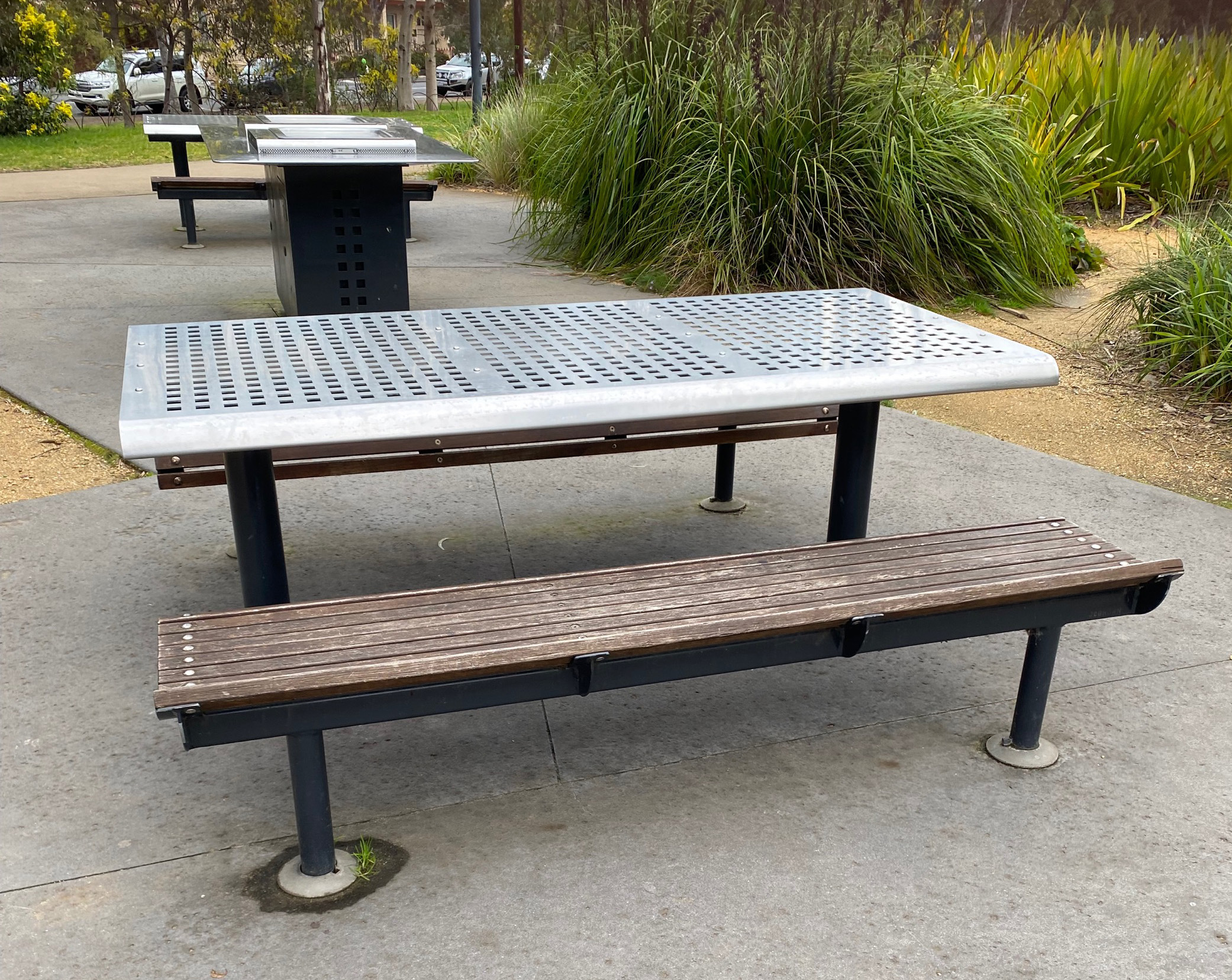
Barbeque sensors installed at Nature Playground
31 January 2023
-
Timeline item 11 - complete
A second AIRS sensor added to a bike path
31 January 2023
-
Timeline item 12 - complete
A second sensor added to cricket nets
7 February 2023
-
Timeline item 13 - complete
Two people counting sensors installed
17 February 2023
-
Timeline item 14 - complete
Data collection period
February 2023
-
Timeline item 15 - complete
Data dashboards to be shared online
4 July 2023
-
Timeline item 16 - complete
Five more yabby sensors added to the Nature Garden
11 July 2023
-
Timeline item 17 - complete
10 Lux level sensors added to Royal Park
8 August 2023
-
Timeline item 18 - complete
3 people counting sensors installed in Circle Grassland
12 September 2023
-
Timeline item 19 - active
Analysis and review
Ongoing from October 2023
Royal Park
Select the points on the map to find out more information about the individual sensors.
To use the map, zoom in and out using the top left navigation. You can also type an address into the search bar.
The data
This is a snapshot of the data we’re collecting in the park through different sensors. This data helps identify patterns about park users.
Hover your cursor over different parts of the dashboard to see more information.
The details
Argyle Square in Carlton was the first Melbourne open space to be ‘sensed’. A variety of sensors including micro-climate, motion, bin and pedestrian sensors were installed to capture data in the park and help us understand how it’s used.
We installed stickers with QR codes and developed a map (download it here) so our community can see the data and learn about how the sensors work. We’ve also hosted tours and workshops to speak to people about this project. Follow Data in the park – Argyle Square to stay up to date.
We’ve been collecting and storing data from Argyle Square since 2020. The data shows trends and patterns of use and helps us understand things like which benches are the most popular for sitting on, which days and times the park is busiest, the impact of different trees species on micro-climates, the bins that get the most rubbish and more.
With these insights, the data can support how we look after the park. In addition, the data can inform future park designs. Due to the success of this project, we will consider other opportunities where sensors can collect data and inform design and maintenance of Melbourne spaces for better city experiences.
Royal Park was selected as the second open space site to be sensed. Sensors in the park will collect data to inform the masterplan.
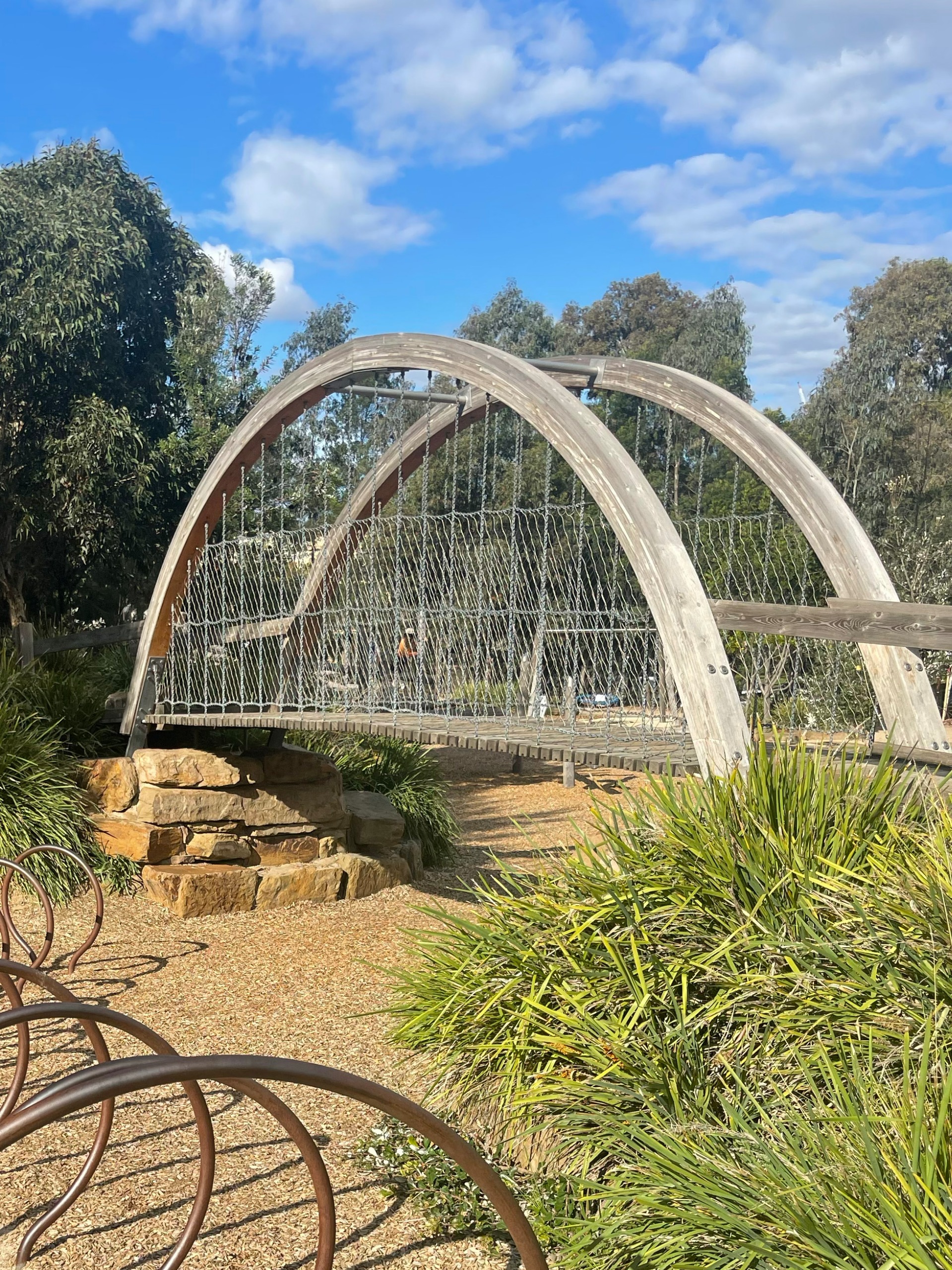
The first area of the park to be targeted is the Nature Playground. This award-winning playground receives high visitation and requires maintenance throughout the year to keep it in good condition.
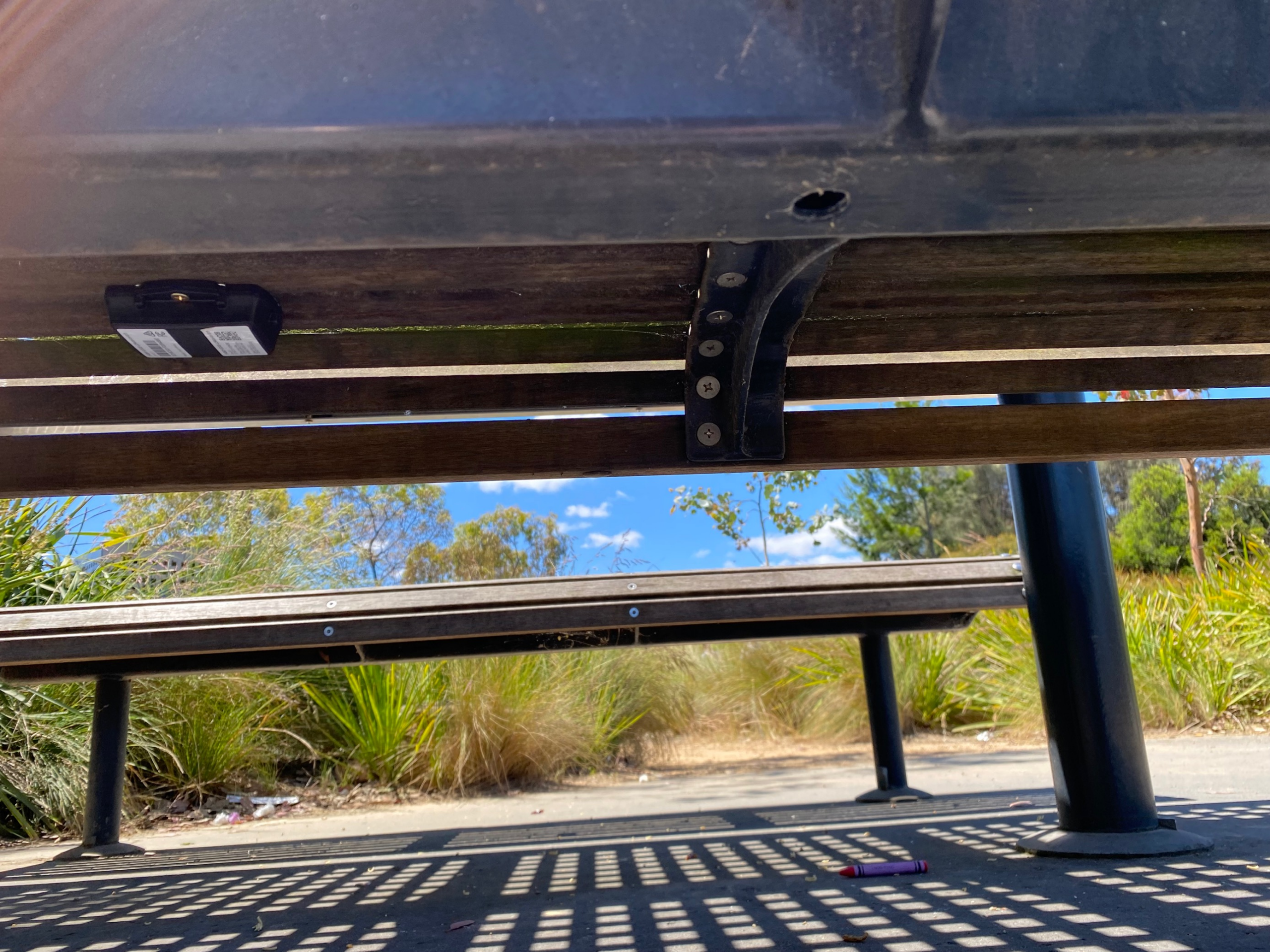
In August 2022, the first five sensors were installed in the park. These sensors are small devices – as small as the palm of your hand – called accelerometers that use batteries for power. They collect data when the device senses acceleration forces in any direction and send it to us via low power wide area networks or LoRaWAN. When someone uses a piece of equipment with a sensor on it, the movement created from playing will be sensed and turn into a number so we can see usage counts over time.
Another sensor that detects pedestrian and bike movement was installed in a key thoroughfare in the park. This is to help us understand the flow of users over time. This sensor – Artificial Intelligence Road Survey or AIRS – detects users and turns their actions into X/Y coordinates by processing the information on-board the sensor in the park. Footage is discarded after it is analysed by Artificial Intelligence.
We will add more sensors and share information in 'The Technology'.
Learn more about the devices in ‘The technology’ or reach out to learn more at smart.cities@melbourne.vic.gov.au.
This project allows data to provide insights into questions such as:
- What are the busiest times and days for popular play equipment?
- What is the typical usage of park equipment before maintenance is required?
- How much is the pedestrian bridge in the park used during peak play periods?
- What is the use of the tallest slide compared to a popular swing on a busy day in the park?
- How often is the BBQ area used in the park and how does this vary between seasons?
- How many pedestrians pass through a key thoroughfare compared to bikes during peak transit times?
As well as supporting park planners, designers and maintenance crews, the data can also empower the community to have more involvement in shaping our shared community spaces.
We will collect and review the data over a period to understand if the sensor network leads to valuable insights.
The results may lead to a change in the type of sensors used or their locations in order to collect more useful data. These details will be shared here. We will work with park rangers, planners and designers to review the data and ensure it can contribute meaningfully toward the next masterplan.
As part of the stage one Masterplan review, we will share any insights from the collected data with the community over the next twelve months.
Stay tuned and revisit this page as we continue to update it with project details.
Click ‘Follow’ to get notified about project updates. You can also reach out to us with any comments or questions at smart.cities@melbourne.vic.gov.au.
The technology
- Digital Matter Yabby Edge - accelerometer
- VivaCity Artificial Intelligence Road Survey sensor (AIRS) - pedestrian and bike sensor
- ICT AWS500 Weather Station – temperature, humidity, air pressure, wind direction and speed
- TCR-LSS Slow Traffic Counter – pedestrian sensor using radar
- Skyfii Mobile Phone Counter – pedestrian sensor detecting wifi and bluetooth
- Taoglass Edge Connect – bin fill level sensor
- Farmo people counter – pedestrian sensor
- Netvox light level sensors – light sensor
- Slide usage
- Swing usage
- Bridge usage
- Water play area usage
- Pedestrian and bike counts and peak times
- Key pathways of movement for commuters
- Speed of movement of bikes and pedestrians at various times
- Barbecue usage
- Bin usage
- Pedestrian and bike speeds and direction of travel
- Weather information including temperature, humidity, air pressure, wind direction and wind speed
- Light levels in the park
Data from the Yabby Edge sensors is collected to help us understand how people use the playground so we can consider this in the masterplan. For instance, we can use the data to learn which items are used more than others, which equipment needs maintenance most frequently, peak times of use and more. This will directly inform future planning and design of playgrounds.
We will collect data using the AIRS sensor to understand flow of people through the park and their transport modes to inform future pathways and master-planning of Royal Park and other parks. For instance, it will be able to tell us what time the pathway is busiest, which modes are more popular at different times, and if there are any opportunities to improve movement through the park through different designs.
Yabby Edge sensors use low power wide area networks or LoRaWAN to send the data. The VivaCity AIRS sensor will use 4G networks to send data. The data is sent to City of Melbourne’s Azure data lake.
The data is used by City of Melbourne to design, plan and maintain Royal Park and other green spaces. It will also be used to understand the opportunities and impacts. The data will be shared with the community via a dashboard on this page soon.
This data is stored permanently for any possible future analysis.
For the AIRS sensor, no video footage is stored or transmitted. The only data that is stored is created from analysis of the footage.Sensors in the park


Royal Park Master Plan Review
Stay up-to-date on activities happening in the park and community engagement opportunities as part of the Master Plan Review.


