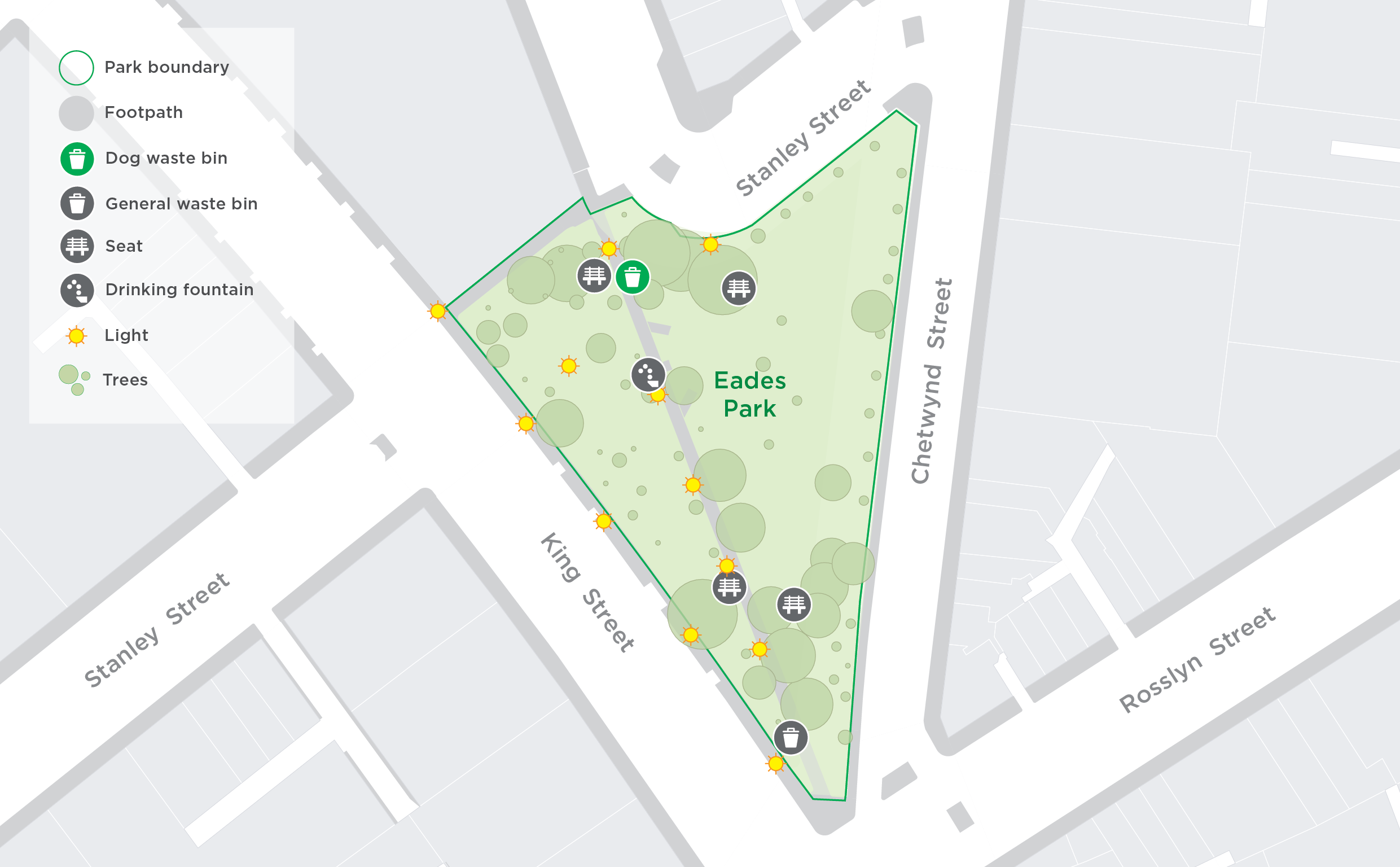
Named after Richard Eades, former City of Melbourne Lord Mayor in 1859, this local park has open grassy areas, shady trees, a playground, fitness equipment and an off-leash dog area.
In 2020, sensors were installed to help better understand how the community uses green spaces in our most popular parks such as Royal Park, Argyle Square and Eades Park. Data captured highlighted trends and patterns of use and helped us understand which seating areas, play equipment, days and times are most popular, the impact of different tree species on micro-climates, the bins that get the most usage and more.
With these insights, data can support how we look after our parks and inform future park designs.
A variety of sensors were used to collect data over six months. Insights are now available to share with the community.
Learn more below in ‘The details’ and hit ‘Follow’ to stay up to date on the project.
Sensors in the park
Our sensors are installed in specific locations to gather data on the use of the dog off-leash area, park benches, bins, playground, fitness equipment and basketball court. We may add new sensors over time and will also share their locations on this map.

Timeline
-
Timeline item 1 - complete
Consultation with planners to understand how sensors could provide insights
November 2022
-
Timeline item 2 - complete
Installation of sensors
February 2023
-
Timeline item 3 - active
Data collection period
from February 2023
-
Timeline item 4 - active
Data analysis
ongoing from March 2023
-
Timeline item 5 - complete
Data dashboard published
August 2023
The live data dashboard
This is a snapshot of the data we’re collecting in the park through different sensors. This data helps identify patterns about park use.
The details
Eades Park is our third park to be ‘sensed’, following successful ‘sensing’ and valuable insights in Argyle Square and Royal Park.
Learn more about these projects at the links below:
- Data in the Park – Argyle Square, sensors installed early 2020
- Data in the Park – Royal Park, sensors installed August 2022
Various sensors were installed to understand key aspects of the park. The sensors have been previously trialed in Argyle Square and Royal Park.
This project will capture data that will provide insights to the following questions:
- What are the busiest times and days in the park?
- How often is the basketball court, playground and fitness equipment used?
- What are the most popular amenities in the park?
- How often are the seating benches used and how does it vary between the seasons?
- How much is the dog off-leash area used and when are the most popular times?
- Which bins are used the most in the park and any patterns of use?
As well as supporting park planners, designers and maintenance crews, the data can also empower the community to have more involvement in shaping our shared community spaces.
We will install sensors to collect and review the data over six months and determine valuable insights.
We will work with park rangers, planners and designers to review the data and understand how it can contribute towards future maintenance and design of Eades Park and our other green spaces.
Insights from the collected data will be shared with the community. Stay tuned and revisit this page for updates.
Click ‘Follow’ to get notified about project updates. You can also reach out to us with any comments or questions at smart.cities@melbourne.vic.gov.au.
The technology
- Digital Matter Yabby Edge - accelerometer that detects movement using battery power
- Bench usage
- Dog park usage
- Playground equipment usage
- Basketball court usage
- Exercise equipment usage
Data from the Yabby Edge sensors is collected to help us understand how people use the playground, fitness equipment, basketball court, dog park, and benches around the park. The data will inform us which items are used more than others, which equipment needs maintenance most frequently, peak times of use and more.
The Yabby Edge sensors use a low power wide area network (LoRaWAN) to send the data. The data is sent to the City of Melbourne’s data lake.
The data is used by City of Melbourne to design, plan and maintain green spaces. The data will be shared with the community via a dashboard on this page and via the City of Melbourne Open Data Portal.
This data is stored permanently for any possible future analysis.


